


Satellite View - Maps - Radar
4.1800.00 Reviews
App Specs
- Version
- 5.7.0
- Updated On
- License
- Free
- Downloads
- 10,000,000+
- Developer
- Mortys Games
- Categories
- Maps & Navigation
- Platform
- Android, iOS
Screenshots
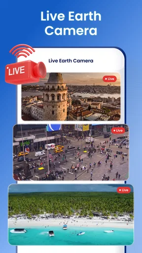
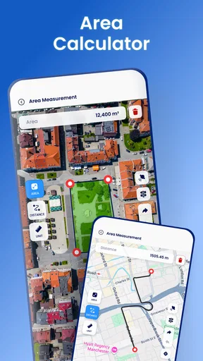
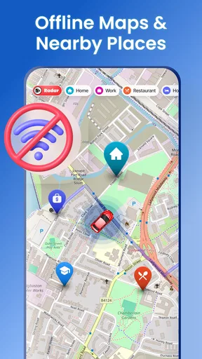
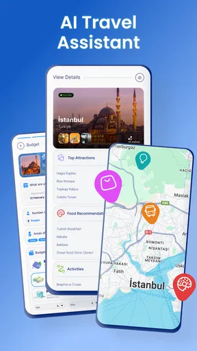
 Analysis by AppCompare
I’m drawn to map apps that let me look around before I decide where to go, and Satellite View - Maps - Radar is built for that mix of curiosity and practical planning. It brings several kinds of geographic information together, so I can browse an unfamiliar area, check the weather, and keep places I may want to revisit. I’d treat it as a useful companion for exploring and preparing, rather than assuming one app can replace every dedicated navigation tool.
What the free download does—and what costs extra
The app is free to download, which makes it easy to try its mapping approach before deciding whether it belongs in your routine. It also offers in-app purchases, with items priced from $4.99 to $49.99. Those figures describe the available purchase range; they don’t tell me which specific tools are included at each level, so I wouldn’t pay on the assumption that a particular feature is part of a certain purchase. I’d first explore the free experience and read the purchase details shown in the app before spending anything.
That distinction matters because the core appeal is the chance to view places in different ways and use the app as a planning aid. If you mainly want to look at satellite imagery now and then, the free starting point may be enough for your needs. If you expect to rely on extra tools regularly, the value depends on exactly what the paid option offers and whether it solves a problem you actually have. The sensible approach is to test your own routine rather than treating the highest-priced item as a necessary upgrade.
Exploring the World in High Definition
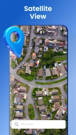
When I first opened Satellite View - Maps - Radar, I was instantly hooked by the crisp, high-definition satellite images. It’s like having a bird’s-eye view of any location you desire. Whether you want to peek at the bustling streets of Tokyo or the serene landscapes of the Swiss Alps, this app has got you covered. The detail is so impressive that you can almost smell the fresh mountain air.
Features That Keep You Glued
What truly sets this app apart is its suite of features. You can switch between different map views, including terrain and street maps, which is super handy when you’re planning a trip or just exploring for fun. Plus, the real-time weather radar is a nifty tool for those who like to keep an eye on weather patterns, especially if you're a bit of a weather geek like me.
For a useful planning routine, I’d start with the satellite view to get a feel for how a destination sits in its surroundings, then switch to a street map when I need clearer road context. Terrain is helpful for understanding hills and the general shape of an area, but I wouldn’t treat a map view as proof that a path is open, safe, or suitable for walking. That’s an important distinction if you’re choosing a route outside a familiar neighborhood: imagery can orient you, while local signs and current conditions still matter on the ground.
The weather layer is most valuable when I use it to make a decision, not simply as something to watch. Before leaving for an outdoor errand or a day trip, I can check the radar and decide whether to bring rain gear or change the timing. Weather displays are a snapshot, though, and shouldn’t be treated as a guarantee for a particular street or trail. I’d combine the overview with common sense and local forecasts when the weather could affect safety.
Worth Reading Before You Choose

EA SPORTS FC Mobile 26 Is a Bigger Football Game, but It Takes Time

Flipboard Shows What News Apps Must Do Beyond the Feed

Switching to Android Auto Means Rethinking Your Driving Routine

Google Calendar Makes a Crowded Week Easier to Manage

Ludo King Makes the Most of the Minutes Between Plans

Baby Panda World Brings Quick Play to Modern Phones, but Its Game Library Feels Busy
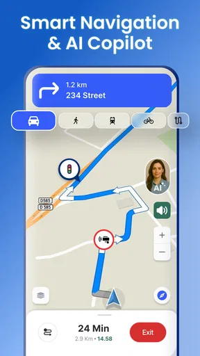
Another feature that caught my attention is the app's ability to bookmark locations. I’ve been saving all the places I dream of visiting someday. It's like building a personalized travel bucket list, and it’s surprisingly motivational. The app also supports GPS navigation, so it doubles as a reliable navigator when you’re on the move. Talk about multifunctional!
Small workflows that make the map more useful
Bookmarks can do more than hold faraway dream destinations. I’d use them to make a short list before a busy day: the station, a meeting spot, and a nearby alternative in case plans change. That keeps the map useful without asking me to search for the same addresses again. For a future trip, saving a hotel and a few nearby points of interest can also help me understand the neighborhood before I arrive.
One practical trade-off is that a bookmark is a reminder, not a complete itinerary. I’d still write down time-sensitive details elsewhere and check that a saved destination is the right entrance or meeting point before setting off. A satellite image may show the broader property clearly while leaving the exact pedestrian approach less obvious. I find it helpful to inspect the street view or map context around the pin instead of assuming the pin alone tells the whole story.
Offline maps are part of the app’s travel-planning appeal, but I’d prepare before losing a connection rather than waiting until I’m already in a dead zone. The useful habit is to identify the area I’ll need and check what offline access entails in the app before the trip. I wouldn’t assume every layer or live feature behaves the same way without internet: radar, for example, is inherently about changing conditions, so it is most useful when current information can load. This makes the app a better backup when planned in advance than a last-minute fix for an unprepared journey.
How it feels beside familiar navigation apps
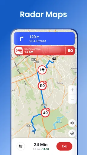
Compared with a standard turn-by-turn navigator, this app’s appeal is broader visual context: satellite, terrain, street mapping, weather, and saved places sit within one travel-oriented toolkit. That combination suits someone who wants to inspect a destination as well as get around. A dedicated navigation app may still be the better choice if your main need is a polished commute routine or detailed route guidance that you already trust. I’d keep the tool that handles my everyday routes best, then use this one when seeing the landscape or checking conditions adds something useful.
It also occupies a different space from a simple weather app. The radar is relevant because it appears alongside maps and travel planning, but I wouldn’t choose it solely as my source for detailed forecasts. Likewise, people who primarily want a map for local business listings may prefer an alternative organized around finding places and checking practical visitor details. The right comparison is not which app has the longest feature list, but which one answers the question I have at that moment: where is it, what does the surrounding area look like, and might the weather affect my plan?
User Experience and Design
The interface is clean and intuitive, making it easy for anyone to navigate, regardless of tech-savviness. I appreciate that the app doesn't bombard you with ads every two seconds, which is a huge plus in my book. The smooth transitions between different views and features ensure that you’re never left feeling frustrated or lost.
For a realistic everyday example, imagine I’m heading across town to meet a friend somewhere I haven’t visited. I can save the destination in advance, look at the street map for the route context, and use satellite imagery to get a sense of the surrounding blocks. If rain looks likely, the radar can help me decide whether to leave earlier or pack a jacket. Once I’m travelling, GPS navigation offers another way to stay oriented. I’d still confirm the actual entrance and follow road signs, especially if the destination is inside a large complex.
People often want to know whether an app like this can be used without a connection, whether it replaces a familiar navigator, and whether the paid options are necessary. Offline maps make preparation relevant, but I’d check the app’s own offline setup before relying on it; for routine directions, I’d compare its navigation with the tool I already know; and I’d treat purchases as optional until I know what they unlock. Those checks are more useful than assuming that every advertised category of tool works identically in every situation.
Where I’d be cautious
A map is only as useful as the information and coverage available for the place I’m viewing, and satellite imagery can look precise without answering practical questions such as whether a road is accessible today. I wouldn’t use a screen view as a substitute for local guidance, posted restrictions, or updated conditions. Nor would I rely on a weather layer alone for decisions where a sudden change could put someone at risk.
There is also a learning curve in deciding which view to trust for which task. Satellite imagery is intuitive for recognizing large landmarks, while street maps are easier for following roads and terrain helps with elevation context. Switching among them is useful, but it can also add steps when all I want is the quickest route. If speed and turn-by-turn directions are the whole job, a specialist navigator may feel more direct.
Satellite View - Maps - Radar is made by Mortys Games and sits in the maps-and-navigation category. Its average rating is 3.9 from around eleven thousand ratings, with roughly four hundred thirty-seven written reviews, and it has passed five million installs. It is rated for Everyone, and the current version is 3.6.0. Those figures suggest a well-used app, but they don’t guarantee that its particular mix of mapping tools will suit every traveller; I’d judge it by trying the views and workflows I actually need.
Who gets the most from it
I’d recommend giving it a try if you enjoy exploring places visually, plan trips in advance, or want mapping and weather tools together. It is especially useful for someone who likes to save destinations and compare a broad satellite view with street-level route context before heading out. Curious users can also get value from simply examining landscapes and neighborhoods without turning every session into a navigation task.
I’d skip it as a primary choice if you need the simplest possible route guidance, depend on a particular offline workflow without checking how it works here, or expect a map image to confirm real-time access conditions. It may also be unnecessary if your current map app already handles your travel planning well and you rarely use satellite or terrain views. Keeping two apps is only worthwhile when this one adds a clear benefit to your habits.
My practical verdict
Overall, Satellite View - Maps - Radar is more than just an app; it’s a gateway to the world. Whether you're planning your next vacation, checking out potential hiking trails, or just exploring out of curiosity, this app is your perfect companion. It's like having a world atlas, GPS, and weather station all rolled into one handy tool. So go ahead, give it a whirl, and let your wanderlust run wild!
My more measured recommendation is to start with the free download and test a specific task: save a destination, compare map views, or check the radar before an outing. If that combination makes planning easier, the app has earned a place alongside your usual navigator. If you find yourself needing faster directions or more dependable details for a specialized task, use an alternative built around that need instead. With optional purchases ranging from $4.99 to $49.99 per item, I’d only spend after confirming that a paid feature is genuinely useful to me. Satellite View - Maps - Radar is worth trying for visual exploration and flexible trip preparation, but not a reason to abandon a navigation tool that already works better for your daily routes.
Pros
- High-resolution satellite imagery available.
- User-friendly interface simplifies navigation.
- Real-time weather radar feature included.
- Comprehensive global map coverage.
- Offline mode for viewing saved maps.
Cons
- Heavy on data usage when online.
- Ads can interrupt user experience.
- Limited features in free version.
- Occasional lag in loading maps.
- Some areas lack detailed coverage.
FAQs for Satellite View - Maps - Radar
What features does Satellite View - Maps - Radar offer?
Satellite View - Maps - Radar provides a comprehensive set of mapping features including real-time satellite imagery, detailed street maps, and live radar for weather updates. Users can explore different locations worldwide, access traffic updates, and customize their viewing experience. The app also allows users to bookmark favorite spots for quick access.
Is Satellite View - Maps - Radar free to use?
The app offers a free version with basic features, allowing users to enjoy satellite views and maps. However, for advanced features like live radar updates, ad-free experience, and additional customization options, users may need to purchase a premium subscription. Details about pricing can be found within the app.
How accurate is the real-time data provided by Satellite View - Maps - Radar?
Satellite View - Maps - Radar uses reliable sources to ensure accurate real-time updates. The app frequently updates its satellite images and radar data to provide the most current information. However, users should be aware that external factors like weather conditions can occasionally affect data accuracy.
Can I use Satellite View - Maps - Radar offline?
While Satellite View - Maps - Radar is primarily designed for online use to provide real-time data, it does offer limited offline functionality. Users can download specific maps for offline viewing, but features like live radar and satellite updates require an internet connection to function properly.
Is Satellite View - Maps - Radar compatible with all devices?
The app is compatible with most Android and iOS devices. It requires a minimum operating system version, which is typically outlined in the app store description. Users should ensure their device meets these requirements for optimal performance and access to all features.


